
Capturing Terrain Data and Transferring Models
As part of an architecture project located at a higher elevation, terrain data first had to be integrated into the digital modeling process. Once the design was completed, specific points and lines from the digital model could then be accurately transferred back onto the real-world site – a valuable aid for visualizing and evaluating the design under actual conditions.
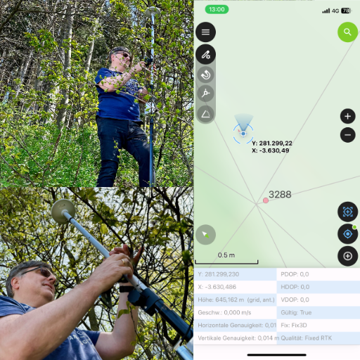
Since commercial solutions in this field often cost several thousand euros, the goal was to find a much more affordable alternative based on open-source tools. Starting with GNSS hardware modules from ArduSimple and the mobile GIS application QField – which integrates seamlessly with the open-source GIS software QGIS – a highly cost-effective solution was developed.
SketchUp was used for the modeling process, extended by a custom-built plugin (see OGI-IT Sketchup Tools.
Although similar technologies have been established in the professional field for some time, this project demonstrates how targeted cost reduction can make such solutions accessible to smaller-scale or private users – while also providing an excellent opportunity to engage more deeply with the technical aspects of the technology.
The components used in this project also offer a flexible foundation for future projects.