
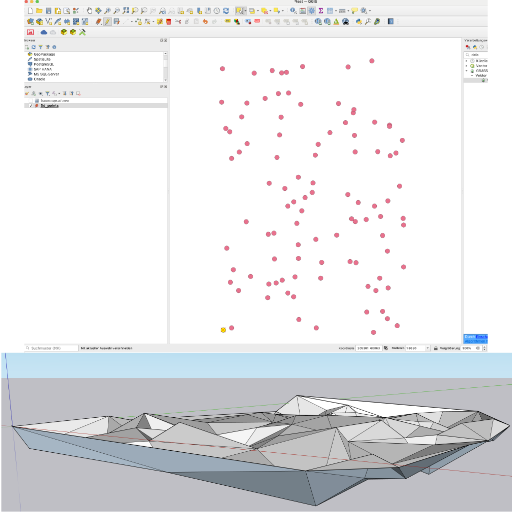
The OGI-IT SketchUp tools were developed to enable the import of high-precision terrain data into SketchUp as a 3D mesh.
They also support exporting the edges of a SketchUp group (e.g., a house model) back into a GIS environment. Using a mobile app, these exported edges can be projected onto the actual terrain.